Newport-Bermuda Race, 635 nautical miles at a heading of 164°34′ magnetic.
“East is Least, West is Best” – meaning variation is subtracted from True heading when East and added when West.
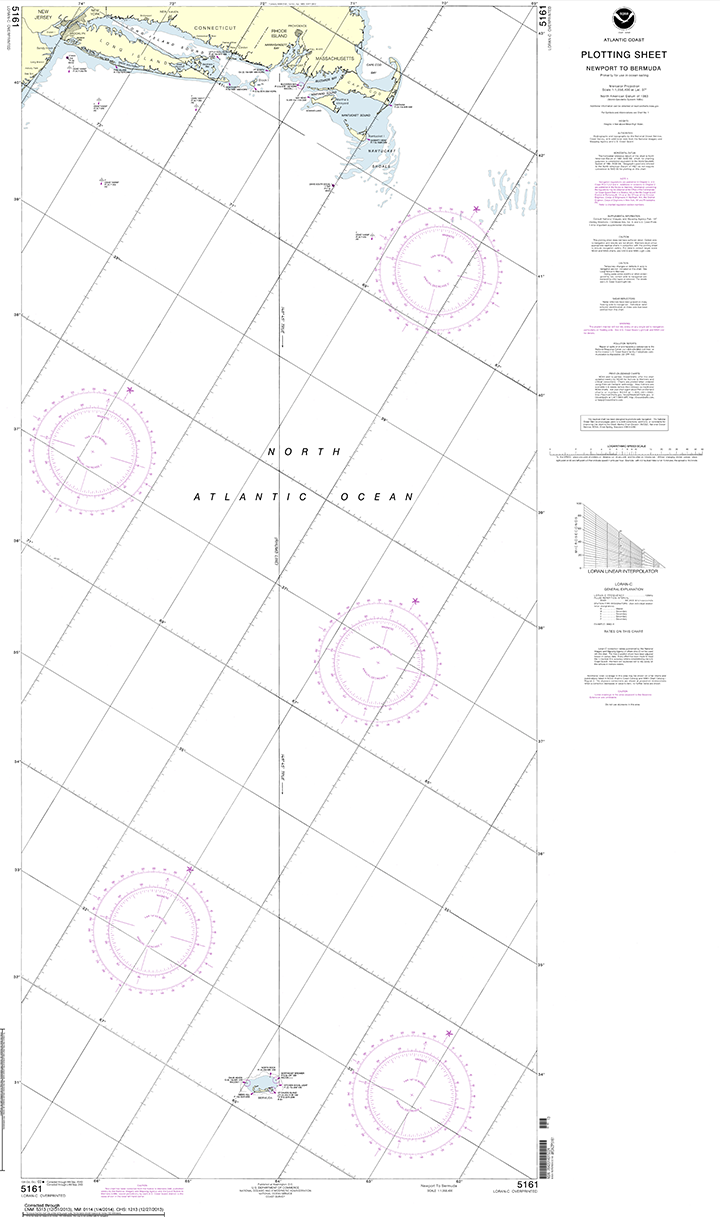
Rhumb Line shows Compass rose at center of chart shows 148°45′ True heading. Compass rose shows VAR 16°00′ W(2003) and ANNUAL DECREASE 1′. Not that precision is required to that degree (pun intended)…but nice to share some basic knowledge.
2014 – 2003 = 11 of the 1′ decrease.
VAR = 16°00′ minus 11′ = 15°49′ W
15°49′ + 148°45′ = 164°34′ magnetic heading from Newport, Rhode Island to Kitchen Shoals, Bermuda. The distance is 635 nautical miles. Little bit of trivia…sailors don’t often bother to convert nautical miles to statute but in the instance of the Bermuda Race it is significant enough to change your perspective a little… 635 nautical equals 731 statute miles.